
Today, we spent the day running from the Williams Mine Fire in the Gifford Pinchot National Forest. It’s been a few days now and the fire has grown to 5000 acres and is 1% contained. Estimated containment date is 10-31-24, so our mountain bike riding in this part of the National Forest is done for the year. It is likely the fire will burn until it starts raining. Between now and then, a lot of beautiful National Forest will be burned.
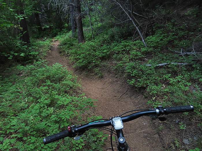
Early the previous morning, a series of thunderstorms rolled through the area. By Cascade Mountain standards, they were pretty mild, not all that much rain. Of course, the big danger with thunderstorms is lightning, which is the leading cause of forest fires. I did not see much lightning, but it was early in the morning and my view is limited because of very tall trees. We went bike riding yesterday and did not see fire smoke in any direction. The rain from the thunderstorms had improved the dusty trail conditions and we had an excellent mountain bike ride.
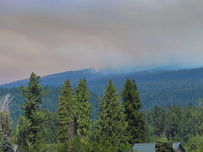
The morning of the fire was much different. Thick smoke and a great deal of falling ash. As soon as I got up and looked around, I knew there was a fire fairly close because of the falling chunks of ash.
I could see the fire was off to the northwest and fairly close because the column of smoke was pretty narrow. I didn’t hear anything on the ham radio, so I texted my friend Gail about sixty miles away who had a view of the mountain. She sent me a series of photos where I could see the fire was about where I thought it was and was growing quickly with increasing wind.
The ashes from the fire were raining down at the campsite. There were no communications on my handheld ham radio that was listening to the local Search & Rescue repeater. This fire, fairly close by had just come to life in the past few hours. The fire was NW of me and the wind was from the north, not good. I thought the fire was about two or three miles away. With a 10-15 mph wind blowing in my face, I knew this spot would be on fire in a few hours.
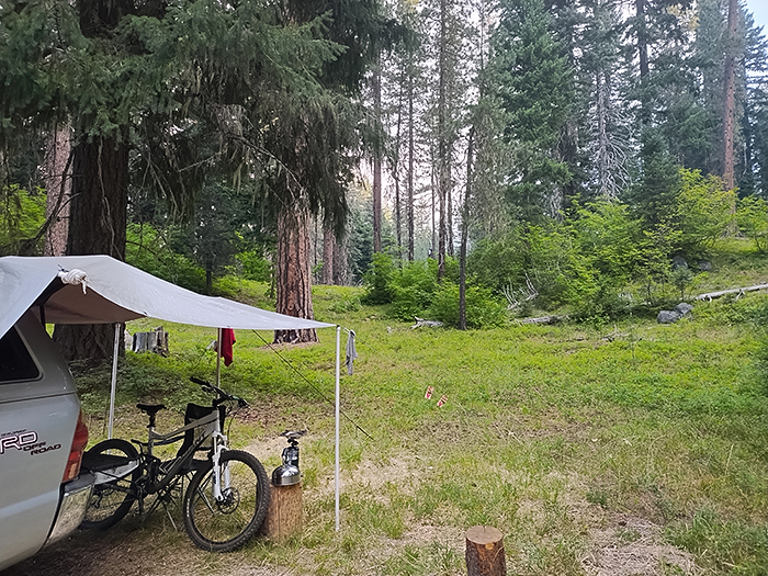
I got everything packed up and ready to go. The smoke was getting thicker as the sun rose above the tall forest trees, bathing everything in smoky orange light. I’ve been camping and riding bikes here for more than fifteen years. Today, I took a few photos knowing that this spot would be burned to nothing in a few days.
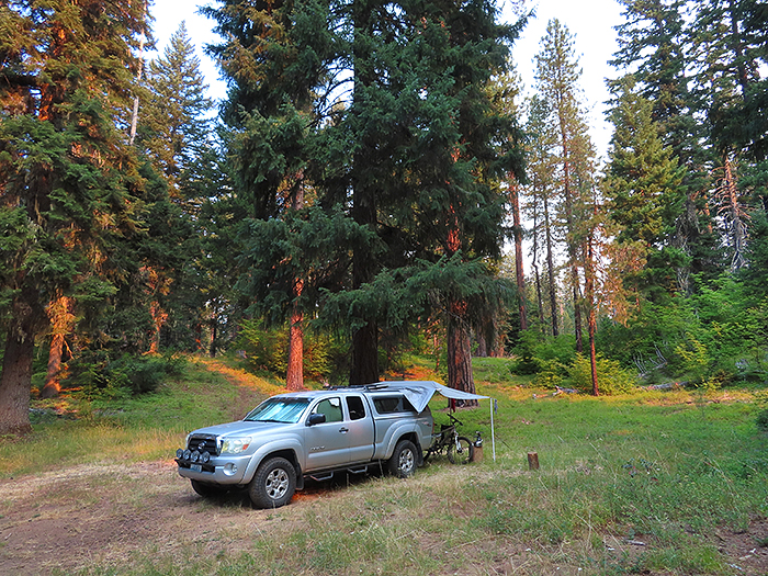
The serious fire situation was only hours old. I can see one of the main forest service roads from here and only saw a few vehicles headed downhill. No fire or Forest Service vehicles. I was ready to go and monitoring the ham radio because the Pacific Coast Trail is nearby and hikers wander into the campsite all the time. If I saw even a hint of flame, it was downhill all the way, there was no immediate danger.
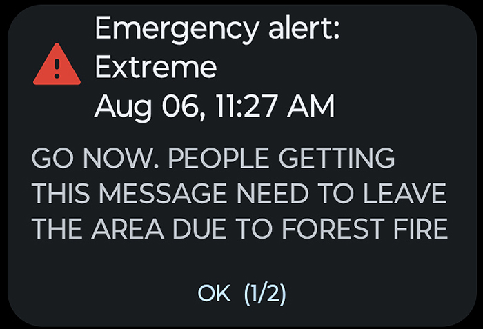
I knew it was coming and it did. No warnings, straight to “Go Now” evacuation order.
I took one last look at one of my favorite Cascade Mountain campsites, hopped in the truck and headed down the mountain.
There were no fires downhill of me so I made it out of the forest without any problems. I stopped to make sure everything was still attached to the truck. Looking back, I could see the fire was just starting. Nothing you can do but watch.
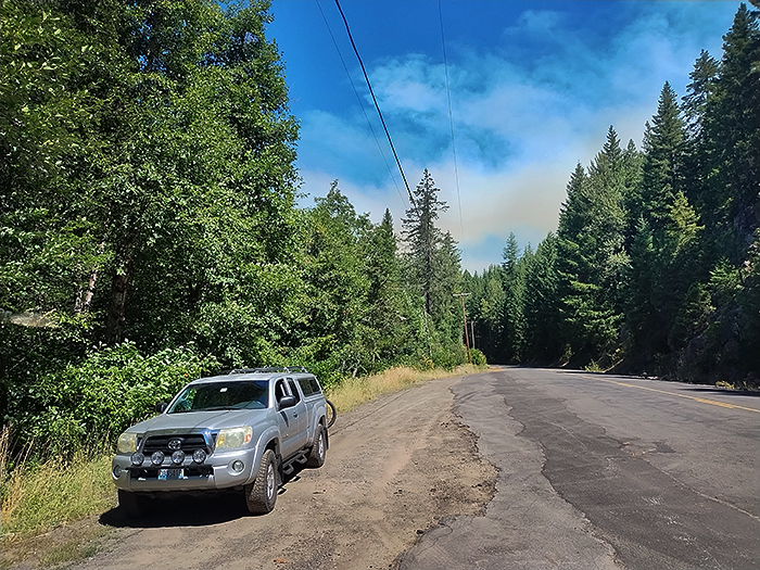
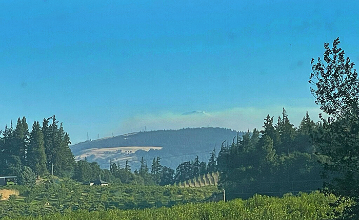
A few minutes later, on the way out of Trout Lake, I stopped for a couple photos. It was windy and the fire was growing fast. There were groups of people who were camping in the fire area scattered around local parking lots. The sheriff was parked in a nearby driveway. A Forest Service vehicle pulled up across the road, the driver got out, took a quick look at the fire, quickly got back in the vehicle and hauled ass towards Trout Lake.
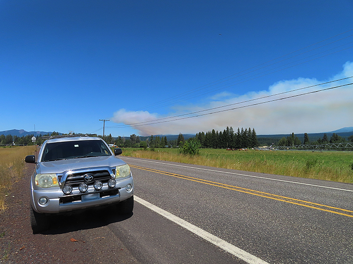
This was the last shot I took. I have a decent camera, but I did not have a tripod for telephoto use. I rested the camera on the bike handlebars and took this shot of the fire.
At the time of the post, the Williams Mine Fire is over 5000 acres. It is one of many wildfires in the area and likely will not be contained for months. The town of Trout Lake is in danger. The area burning is a popular outdoor activity spot. If you’re a local person who spends a lot of time outdoors like I do, this is really a sad day.
Heck of a deal. Although a minor storm, even for our area, it touched off several fires between Mt Hood and Mt Adams. The Williams Mine fire is by far the worst of them by size and growth potential. The area around Mt Adams has had large fires 4 times since 2008. The forest has changed dramatically each time. Sad indeed.
Got here from TW, clicked on a link from one of your posts. I know the feeling of losing a special spot to fires. Back in 2020, the Creek Fire, through the Sierra NF, raged through a favorite camp site that my Dad has been visiting for 30+ years, and that I’ve been camping with him at as an annual tradition that we started in 2018 or so.
Like the Williams Mine Fire, this was one that was scheduled to be “contained” when the snow fell on it, and we watched with sadness as maps showed the fire burning through camp over the course of a couple days.
I will say, fires are interesting beasts. The landscape has changed dramatically, but not everything is gone. We still return every year, and it is fascinating to see how things continue to change (rapidly) post fire.
If you’re curious, trip reports are here: https://adventuretaco.com/tripdest/sierra-national-forest/
Yes, started small but grew quickly. Not many places like this left in the lower 48. It’s going to leave a mark.
Have you ever considered using a fishing rod holder on your kayak for a completely different purpose, such as holding a camera or a drink while you fish? How could you modify a traditional rod holder to better suit your needs on the water?”,
“refusal
I have used the rod holders to hold cameras, radio antennas and navigation lights.